SPEND TWO WEEKS, LIVE TWO CENTURIES
A staccato of heavy rain pelting the roof was incongruent with the early morning sunshine bursting through our bedroom blinds. I bailed out of bed and opened the door of our RV, half expecting to see a rainbow. Instead of rain, a plethora of oak leaves was falling helter-skelter onto our roof, adding to the brown blanket already covering the forest floor. Autumn was changing the Tennessee landscape from verdant green to shades of umber in preparation for winter. With the exception of a cluster of RV’s parked in our primitive campground, the forest scene would have looked the same to early settlers in these parts.
In the late 1700’s, local farmers, hunters, and trappers floated their crops and furs down the Mississippi River to ready markets in Natchez and New Orleans. After selling their now useless barges for timber, they walked or rode horses back to Tennessee and Ohio along an old buffalo and Indian trail know as “The Trace.” For more than 30 years, this heavily traveled trail became an important wilderness road complete with stands (inns) providing food and shelter. With the coming of the steamboat in the 1820’s, northbound travelers no longer needed to walk, and The Trace returned to a quiet forest lane.
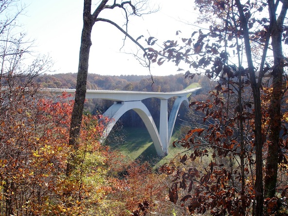
More than 100 years later in the late 1930’s, the government began construction of the Natchez Trace Parkway to commemorate the Old Trace. The New Trace, more commonly called “The Trace,” was designated an All American Road in 1995, one of nine such roads in the United States. Completed in 2005, this 444-mile long Parkway offers travelers an unhurried route northeast from Natchez, Mississippi to Nashville, Tennessee; or southwest if you’re so inclined. Unhurried indeed. The Trace almost demands a relaxed pace to fully appreciate its scenic beauty and historical significance. First, the maximum speed limit on the two-lane road is 50 mph with straight stretches rare as hen’s teeth. Second, motorists must be watchful for deer, wild turkeys, and the occasional bicyclist. And third, as many as 100 points of interest, averaging one every four miles, beckon motorists to stop, look, and learn. If you’re in a hurry, choose another route.
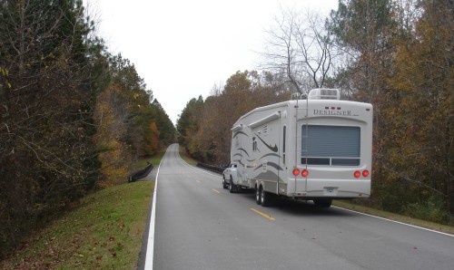
Commercial vehicles, such as trucks, are prohibited on the Parkway. Fortunately, RV’s are allowed and easily accommodated. All parking spaces for restrooms, picnic areas, hiking trails, scenic overlooks, and points of interest are designed for large rigs. Three free un-serviced campgrounds are located on the Parkway, while a half dozen State Parks and a dozen private campgrounds as well as fuel and supplies are available in nearby communities.
A LITTLE BIT COUNTRY
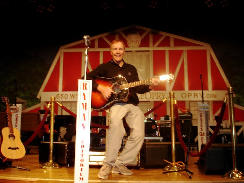
Since the northern terminus of the Parkway is at Nashville, my wife Sandy and I decided to spend a few days in this vibrant city. With over 40 attractions and 200 live-music venues to choose from, we asked several locals what we had to see during our visit. At the top of everyone’s list was The Grand Ole Opry, which I always thought was a building where country musicians performed. It’s actually a live radio show (WSM 650). The Opry was first broadcast in 1925 and has played in several different buildings, including the recently renovated Ryman Auditorium where we watched a toe-tapping country-western show. Between acts, the emcee’s commercials promoted sponsors’ products. Earlier in the day, we had toured this historic building, a monument to legendary musicians such as Hank Williams Sr., Roy Acuff, Loretta Lynn, Patsy Cline, Johnny Cash, and many others who shaped the sounds of country.
Next most suggested attraction was the Country Music Hall of Fame and Museum, a $37-million facility providing interactive displays and exhibits that encapsulate the essence of country music, from pick’n and sing’n in backwoods cabins to venues throughout the world. Y’all can’t have country without the pick’n and sing’n!
We were also advised to visit the very popular Honky Tonk district downtown. In several crowded bars, photos and memorabilia of well-known country-music artists lined the walls. The live music was excellent but LOUD, too loud for our liking. We opted instead for an impromptu Taizé Meditation Service at a local church … very quiet.
On our last night in Nashville, we visited the highly touted Loveless Café and enjoyed a typically southern meal of fried chicken and biscuits followed by another live radio show of country-music performers.
SOUTHWARD HO!
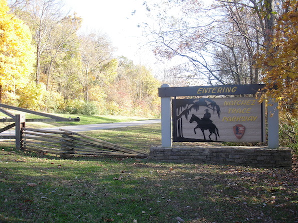
The next day we departed Music City and entered the Natchez Trace Parkway. Along the way, we visited most “significant exhibits” and many others referenced in the Parkway brochure.
Our first stop was a working tobacco farm, complete with the acrid odor of drying tobacco leaves hung in an old barn. An audio presentation describes the arduous task of harvesting and processing tobacco. From the parking lot, we drove our truck along a narrow two-mile section of the Old Trace Road, developed from the original footpath to accommodate horse-drawn wagons.
Meriwether Lewis Campground on the Parkway is located near the grave of Meriwether Lewis, the intrepid explorer of Lewis and Clark fame. While governor of the Upper Louisiana Territory, he died of gunshot wounds here at Grinder House on the night of October 11, 1809 while traveling to Washington. Who inflicted the wounds remains a mystery. Adjacent to Lewis’s monument is a settler’s cemetery. We searched for the most unusual first name among the tombstones: Eugenia, Truvinia, Drucilla, Cletus, Erline, Sam, Fred … take your pick.
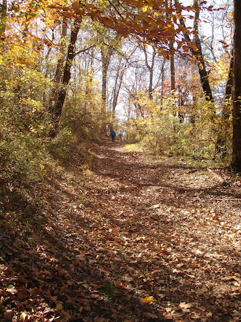
Since the Parkway roughly follows the Old Trace, there are numerous opportunities to stop and explore the original pathway. While walking along a narrow well-trodden corridor through oak, dogwood, and pine trees, we took a mental trip back in time.
Pretending to be travelers returning home to Tennessee after selling our wares in Natchez, we imagined the possibility of being confronted by “shur-nuff” bandits, robbed and possibly killed. Rumor has it many wayfarers were murdered, disemboweled, stuffed with stones, and placed in watery graves, never to be seen again. Enough pretending, it was time to get back to the RV!
Travelers often had to ford streams and rivers in their journey northward. The mighty Tennessee River was the worst natural obstacle, until 1802 when Chickasaw Indian chief George Colbert began operating a ferry. Fees were set at 50 cents per person or horse, half price if you were delivering mail. Reportedly, Mr. Colbert charged General Andrew Jackson $75,000 for transporting his Tennessee army across the river southward to engage the British troops in the War of 1812.
Located just west of Tupelo, Mississippi, Trace State Park offers picture-perfect camping. Our trailer was nestled amid stands of oak and pine on a narrow finger of land, not four ‘gators from tranquil Trace Lake. In Tupelo, we enjoyed touring Elvis Presley’s birthplace and museum, learning about the many influences that transformed a shy young country boy into the King of Rock and Roll. Other notable Americans born along The Trace include Helen Keller, Oprah Winfrey, Eudora Weltey, Medgar Evers, and Tennessee Williams. The Tupelo National Battlefield documents some of the bloodiest and most decisive Civil War battles fought in northern Mississippi during the summer of 1864.
In 1800, the Trace was declared a National Post Road with mail service provided between Natchez and Nashville. Postmen on horseback would leave their respective cities and meet halfway at a post office in Tockshish to exchange mailbags. They would then mount fresh horses and return to their starting points, taking 12 days total. Slightly further south, we visited the area where the Chickasaw Council House once stood, a meeting place where chiefs signed treaties with the Federal Government and established tribal laws. After the treaty of 1832 the Chickasaw territory, and the Choctaw territory to the south, were surrendered to the government and the tribes forced to move to Oklahoma, where they remain today.
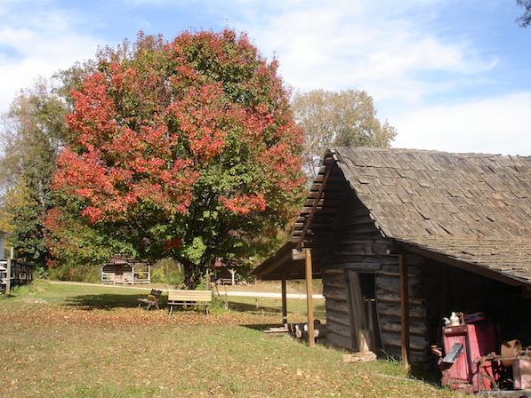
At Jeff Busby campground, we hiked a nature trail to the top of Little Mountain, the highest elevation (663 feet) along The Trace. Just 12 miles south is French Camp, an early American Village complete with a plantation house and a log cabin museum, blacksmith shop, gift shop, and café. A stand established here in 1812 by Frenchman Louis LeFleur later became a school and remains one to this day.
Jackson, Mississippi is the largest city along the Parkway, providing us the opportunity to pop back into the 21st Century to replenish supplies and do laundry at a local campground. Here we visited the Mississippi Crafts Center, which displays an extensive array of traditional and contemporary works created by Southern artisans.
Returning to the Parkway, we pulled over at Cypress Swamp and took a self-guiding trail through a typical southern swamp. Spanish moss hung from bald-cypress trees, a heron and egret stood statue-like in the shallows, and sounds of songbirds filled the air. As the sign-post said: “Its subtle beauty and peaceful setting can soothe a tired soul.” It worked for us, but I doubt whether the early travelers slogging knee-deep through a mosquito-infested bog would have agreed!
Rocky Springs was our third and final campground along the Parkway. Nearby, a shaded stretch of the Old Trace lead to the remnants of a small town called Rocky Springs, named for a spring flowing from a rocky ledge. A sign post urged visitors to “Leave your prints in the dust, not for others to see, but for the road to remember.” Established in 1790, the town grew substantially during the 1800’s. At one point, over 2000 slaves provided labour for the primary crop – cotton. Unfortunately, the Civil War, yellow fever, and the boll weevil ended this once prosperous community. Today, an historic still-functioning church, pioneer cemetery, and a couple of rusty safes and covered cisterns bring the town back to “life.”
Just a long day’s walk north of Natchez at Mount Locust was a plantation and stand built in 1780. The first of 50 stands built along the Old Trace, it is the only one remaining to give visitors a glimpse of rural life during the 1800’s. As we continued south, the mile markers counted down, from 444 in Nashville to now less than 50. We felt our pace slow even more as we reluctantly neared the end of our journey. We stopped for a final walk on the “Sunken Trace,” a deeply eroded section of the original Trace.
And we stopped again at the site of the first chartered school for women in Mississippi, established in 1818. The Elizabeth Female Academy, where Audubon had served on the faculty, closed its doors in 1845. Only a brick wall remains.
NATCHEZ, MISSISSIPPI
Passing the terminus marker at Mile Zero, we bade farewell to the quiet solitude that accompanied us the past two weeks. The frenetic pace of Natchez traffic swept us along to a nearby campground. The next day, we sought out the rough and rowdy barge landing where pioneer raftsmen exchanged their goods for money. Some managed to avoid carousing in the saloons, gambling dens, and brothels. Others succumbed, beginning their return trip penniless and exhausted. The barge landing still has a saloon and a gambling den (a paddlewheel casino) as well as a restaurant, although I didn’t notice any brothels.
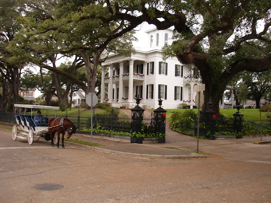
Over the next few days, we explored picturesque Natchez with its well-preserved antebellum (pre-Civil War) homes and elegant mansions. Our horse-drawn carriage driver commented that prior to the Civil War, because of lucrative cotton plantations, over half the millionaires in the United States lived in Natchez. We thus ended our journey with a large dollop of grandeur atop precious memories of a desolate path through untamed wilderness that became a national treasure.
FOR INFO:
National Park Service (includes campgrounds) http://www.nps.gov/natr/index.htm
